
App Designed, Developed and Product Shipped from South Carolina.
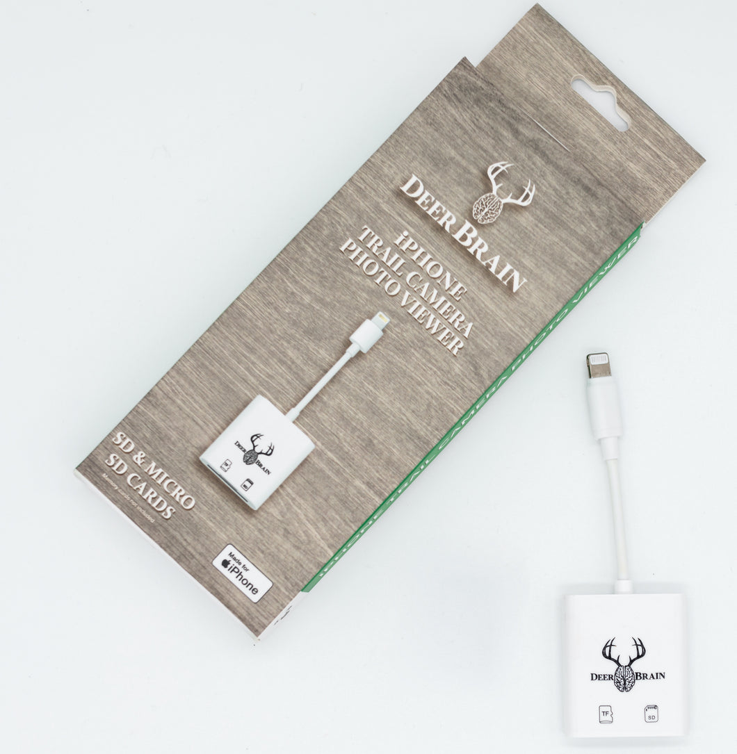
Unleash the full potential of your hunting experience with the DeerBrain SD card reader for lightning cable. (USB-C coming soon) This cutting-edge device revolutionizes the way you review and manage your trail camera photos with its innovative technology. The reader groups your photos by timestamp, making it easy, fast, and intuitive to delete unwanted photos with just a few taps. Say goodbye to the frustration of spending hours sifting through hundreds of photos and hello to the convenience of reviewing 1000 photos in the time it takes to review 200 with a traditional card reader. Find your trophy buck faster and take your hunting game to the next level with the DeerBrain SD card reader. Don't miss out on this opportunity to revolutionize your hunting experience - act now and upgrade today!
See It work
Download the app and review 100 sample pictures for yourself to see how fast and efficient the Chip Reader is.
Experience the Premium Quality of an MFi Certified Accessory - for lightning cable.
Apple Made for iPhone (MFi) Certified - Only the Best for Your Apple Devices.
DeerBrain is proud to be part of Apple's exclusive list of MFi certified products and proudly displays the MFi badge. By choosing DeerBrain, you can be sure that you are getting the highest quality, Apple recommended accessory for your device.
Search the Apple MFi certified list and you'll see that DeerBrain stands out among the best. Unlike many other chip readers, our product has been approved by Apple and carries the MFi logo, a sign of Apple's strict standards for quality components. We are committed to ensuring that you have the best experience possible with your Apple device.
And if you're not satisfied with your purchase, our satisfaction guarantee has got you covered. Don't settle for anything less than the best. Choose DeerBrain - an MFi certified accessory that you can trust.

Additional Features
Save/Share/Delete photos directly from your phone
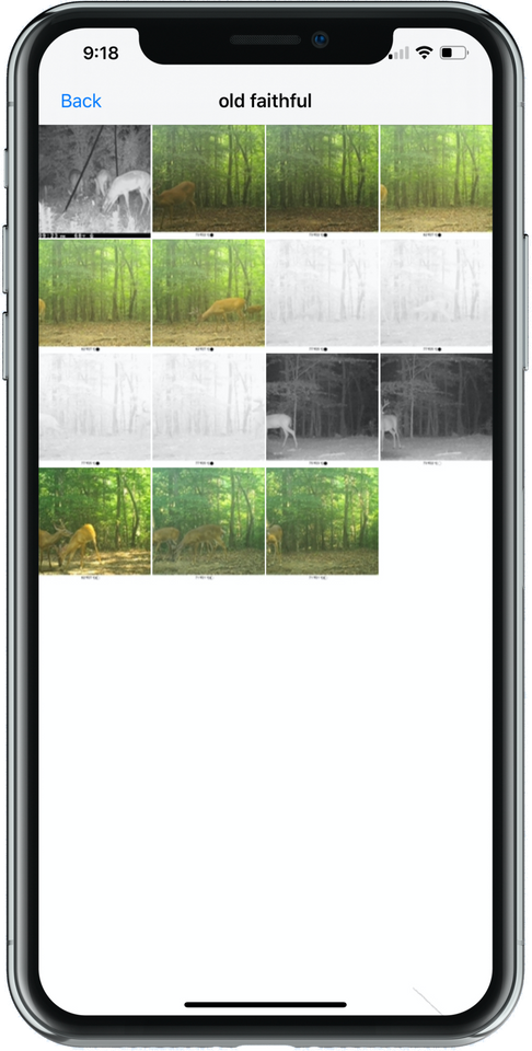
Photos can also be viewed individually or as a whole in each time stamp making viewing faster and easier.
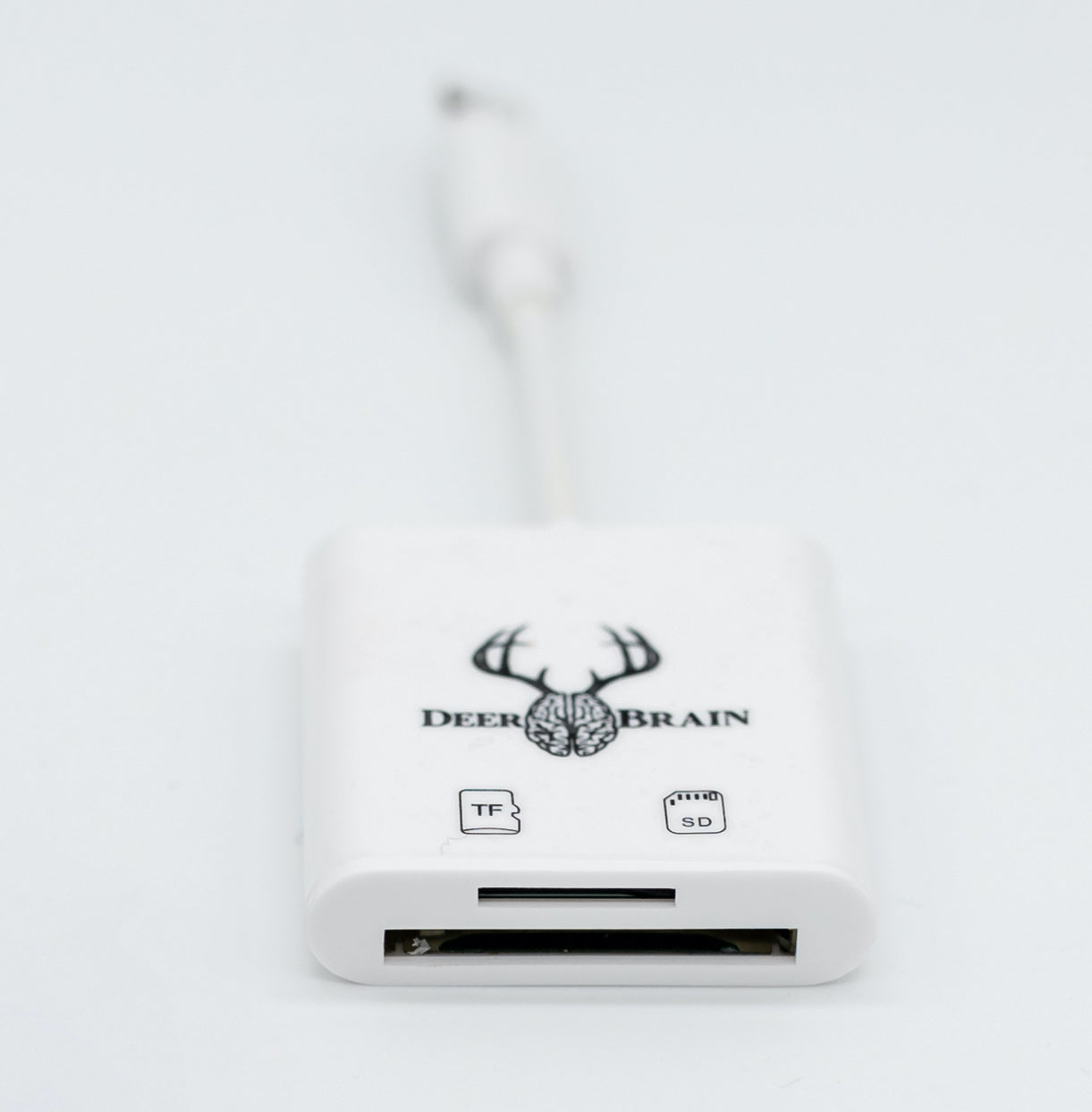
SD and Mirco SD compatible
USB 3.0 speed
Slim lightning cable allows you easy access to the bulkier iPhone cases
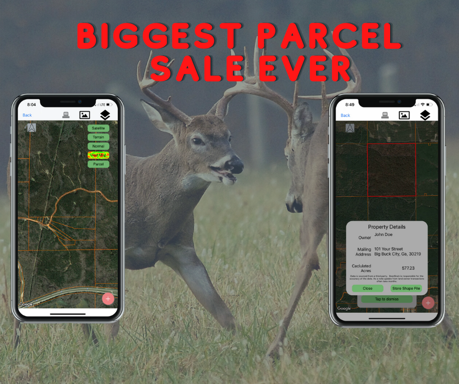
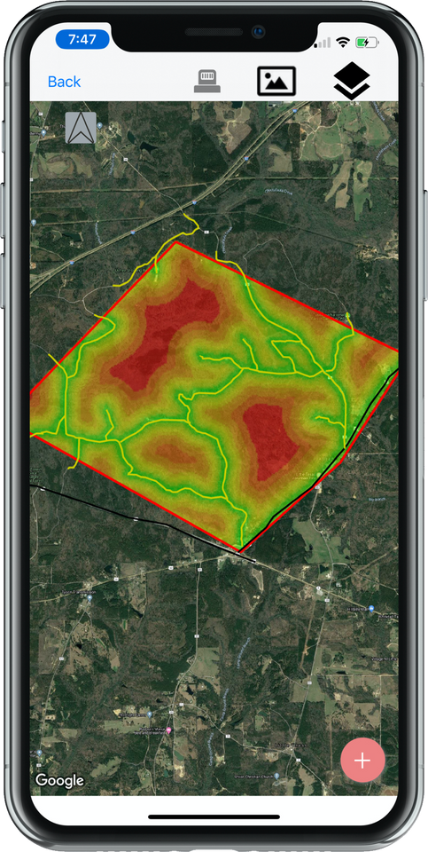
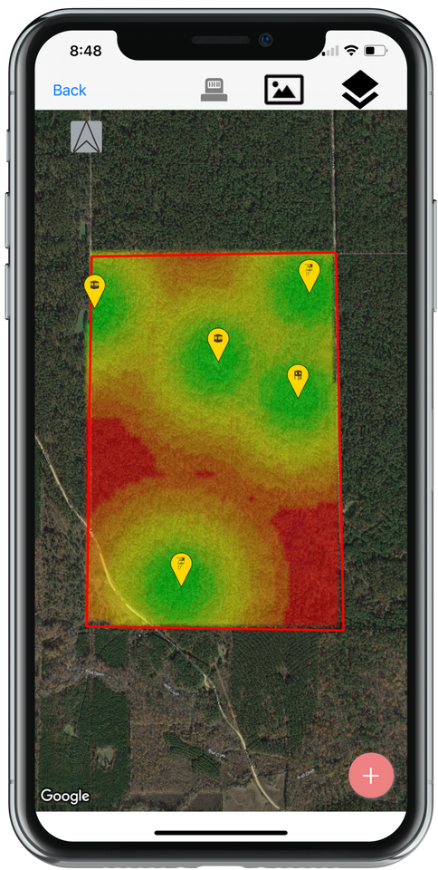
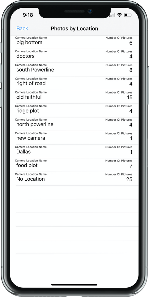
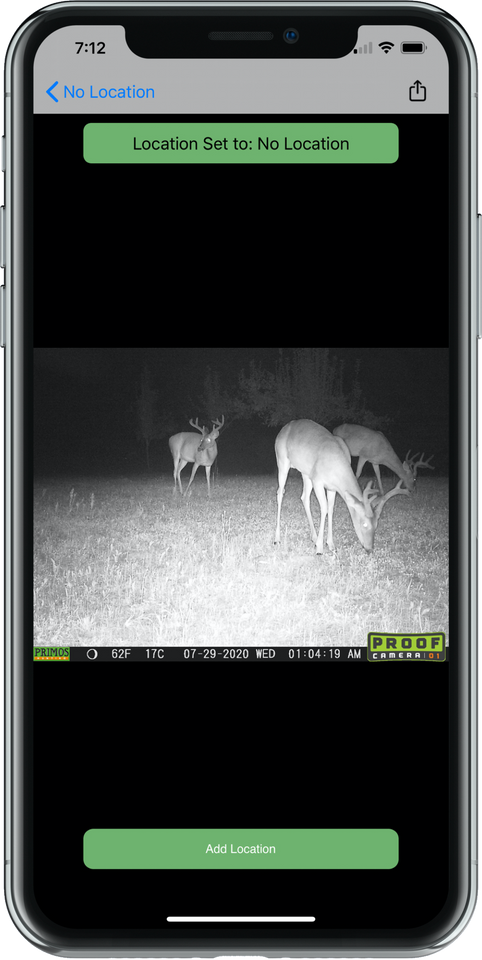
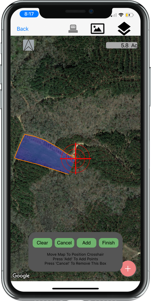
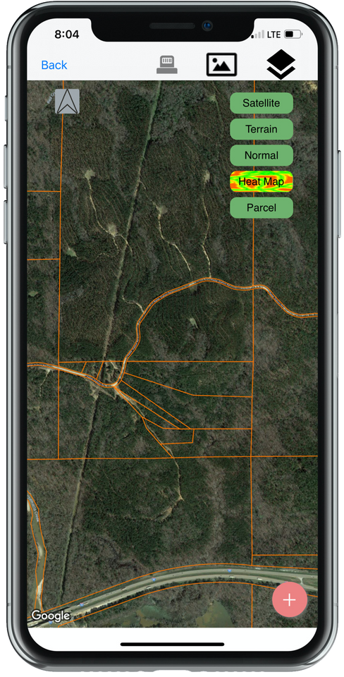
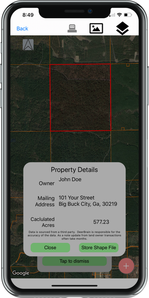
Save your photos to a location and review all trail camera photos from that hot spot.
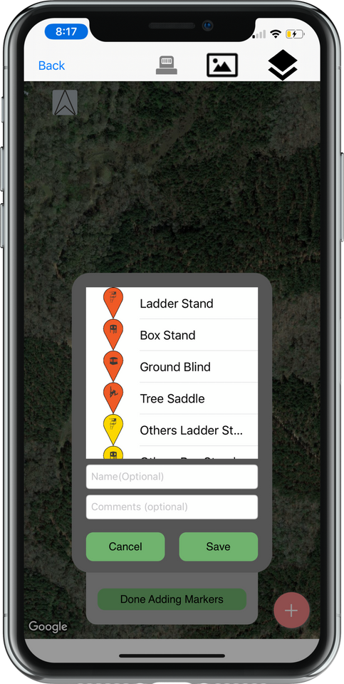
Create a Name for your Target Bucks and review photos quickly with the Hit list
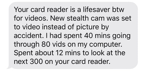
User Feedback.


Deer Season Risk Free Guarantee - Best Guarantee in the Market.

At DeerBrain, we believe that hunters deserve only the best tools and technology to help them succeed in the field. That's why we've created the ultimate SD card reader, which boasts exceptional quality and performance. Certified by Apple's Made for iPhone program, our SD card reader is built to last and stands out from the rest with its sleek design, easy setup, and wide device compatibility. Plus, it's faster, more durable, and more user-friendly than other SD card readers available.
But we're not just confident in our product - we guarantee it. With a 3-year, no-risk guarantee, you can try the DeerBrain SD card reader for the next three deer seasons with complete peace of mind. If you're not completely satisfied and wouldn't refer it to a friend, simply return it for a full refund.
At DeerBrain, we're more than just a company - we're a team of avid hunters, app developers, and designers who run dozens and dozens trail cameras and are constantly working to bring you new and innovative products and strategies. We believe in the DeerBrain SD card reader so much that we're willing to put our reputation on the line. Try it out for yourself and see why the DeerBrain SD card reader is the best on the market.